Assess

Display Module
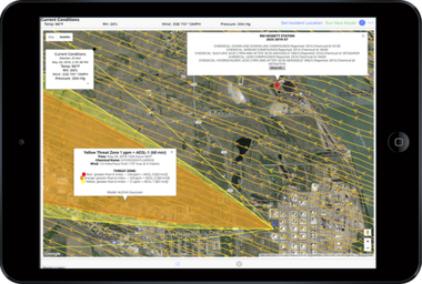
LR-x® works seamlessly with CAMEO Chemicals, ALOHA, MARPLOT, and other modeling systems, reading current and forecasted weather condition models. These seamless integrations make it easier to model toxic plumes over roadmaps, satellite images, Google Maps and Google Earth to provide the most current information possible viewable on a mobile device or iPad.
Terrain and satellite view, in addition to resolution settings are several of the user-friendly, customization options. Saving time from deciphering information, color coded wind speeds and streamlines provide easy to read current and forecasted models.
The 60,000 Tier II Chemical Plants listed in our database provides an immediate historical overview of chemicals housed at a particular location, in addition to site contact information.

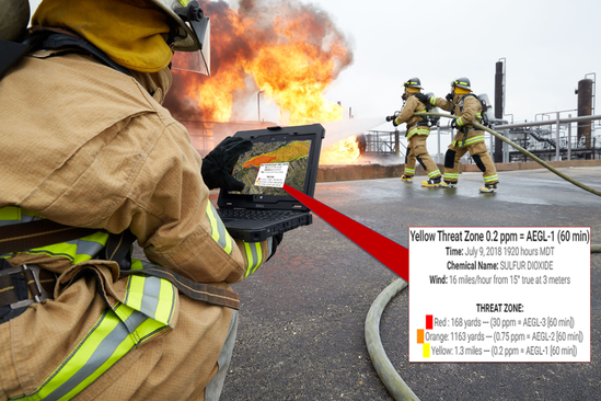
By clicking anywhere within the plume Threat Zone, information is displayed in an easy to read format.
- Red - Health effects that are life threatening or result in death
- Orange - Health effects that are irreversible, long lasting adverse effects, and/or impaired ability to escape
- Yellow - Health effects that are not disabling and are reversible upon ending exposure


