Plume modeling for hazmat response teams
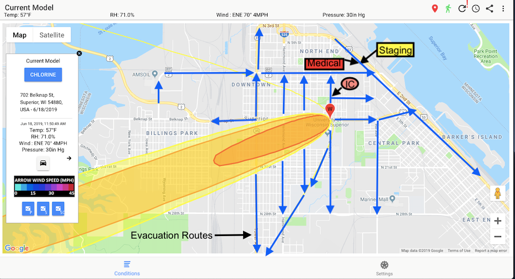
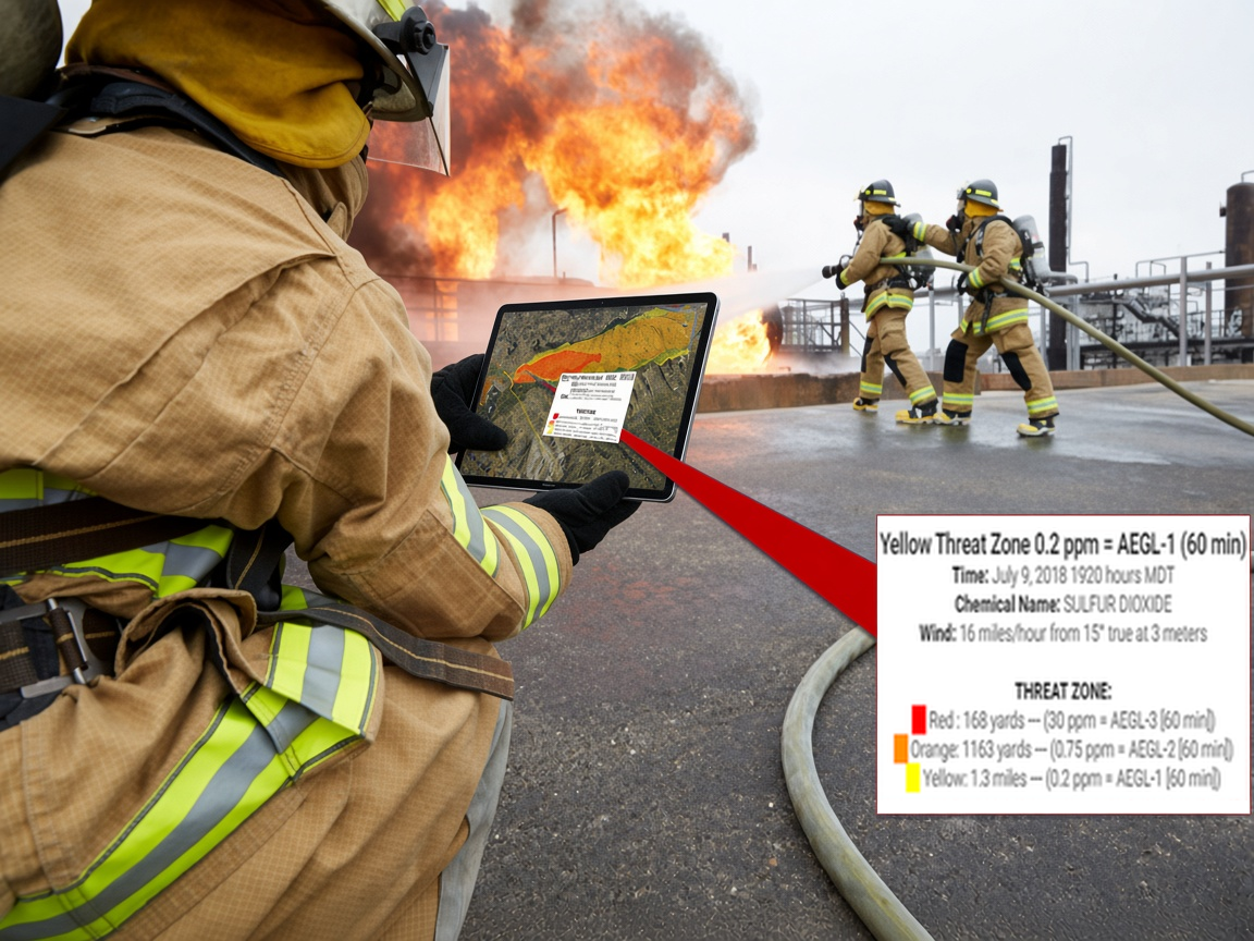
Run ALOHA plume models over a 3D wind field from a tablet while en route, and arrive with a threat zone already on the map.
- Start a model from the incident address or a dropped pin, using the nearest public weather station.
- Touch-and-go ALOHA parameters: incident name, time, location, chemical and release details. Advanced settings cover ground roughness, source and threat zone.
- Red, orange and yellow AEGL threat zones with distances you can tap for detail.