
What is LR-x® Technology
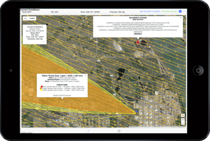
LR-x® is a paradigm shifting mobile (Apple & Android), easy to use cloud-based technology for heightened situational awareness of plumes related to chemical spills, CBRN threat, airborne hazard events, and wildfire management. By producing a hazard visualization in near-real time, first response decisions can be made using 3D Wind Field and ALOHA model results in under 5 minutes. These seamless integrations model toxic plumes and 3D Wind Fields over roadmaps, satellite images, Google Maps and Google Earth provide the most current information possible.
LR-x® is based on patented technology developed and licensed exclusively to Diamond B Technology Solutions by the U.S. Army Research Laboratory under U.S. Patent 9,911,303 issued March 6, 2018.
Developed by the
|
Near Real Time
The LR-x® system maps wind field and toxic plumes in near real time utilizing up-to-date 3D models to ensure proper safe zones are established and to assist in proper mitigation of the threat. It also tracks dangerous wildfire smoke and assists in focusing wild fire management efforts. |

Terrain SensitiveLR-x®’s unique technology can also reveal eddy currents which concentrate toxic plumes around buildings and structures providing the safest ingress & egress locations during a hazardous chemical release. |
Industries Served
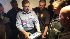
· HAZMAT REsponse Teams/First Responders
|
Utilizing public weather sensors, or portable weather sensors already in place near critical infrastructure, HazMat Response Teams can begin assessing the impact of a chemical plume release in as little as 5 minutes.
|
· Industrial / Chemical Industry
|
Any workplace that handles dangerous chemicals can greatly enhance worker and civilian safety through utilization of the LR-x® system in tandem with strategically placed fixed atmospheric sensors around their facility. Industrial HazMat Response Teams will gain valuable insight into how both current and forecasted weather conditions may affect the dispersion of a release providing them with life saving information.
|
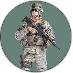
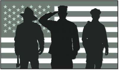
· Military/CBRN
|
|
Military elements deployed in potential hot zones can rapidly deploy the LR-x® system to determine CBRN threat levels to troops in place and determine best course of action for troop response. This scenario was one of the key drivers in the Army Research Lab's work in developing the original L-REAC system, (rebranded as LR-x®).
|
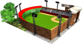
· Public Venues & HAZMAT Response Training
|
Fixed sensor suites strategically placed around and near stadiums, hospitals, schools, and other public gathering venues, connected to the LR-x® system, provides a tool for officials and HazMat teams that could not only save lives, but minimize panic. It is an effective tool for officials and HazMat teams to create accurate simulations for response training at public venues.
|
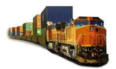
· Rail
|
Using your existing weather sensors the LR-x® system's 3D Wind Field model will allow you to visualize wind streams over complex terrain assisting your engineers on determining how the weather will impact the locomotive. In emergency situations the LR-x® system can be deployed prior to the arrival of first responders to a rail disaster safeguarding your employees, first responders and the local community.
|
· Wildfire management
|
|
LR-x® is a versatile system that is a proven asset in assisting in the management of wildfires. In April 2011, ARL was able to test LR-x® (as L-REAC) in a real-world emergency. The system performed as designed and was considered by civilian emergency responders as being a vital tool in their efforts.
|
First Responder Focused
Deploy
|
Assess
|
Communicate
|
Events / Conferences / Exhibitions
Thank You for a Great Turnout at the 2019 Florida HazMat Symposium!
Follow us on Facebook and Twitter for additional information on upcoming events, conferences, and exhibitions.
January 22-25: Florida HazMat Symposium - Daytona Beach, FL
March 7-8: WAHMR Conference - Madison, WI
March 24-28: Fire House World Conference - Los Angeles, CA
June 13-16: IAFC HazMat Conference - Baltimore, MA
Next up...
September 24-27: The Continuing Challenge - Sacramento, CA (Instructor)
For more information or to schedule a demo contact [email protected]
Do you have a conference or panel discussion approaching and want a knowledgeable member of our team to attend or present?
We enjoy educating hazmat teams of technology that increases situational awareness and decision support that keeps First Responders, HazMat Teams, and other public officials safe! Contact us to request attendance via on-site booth, presentation, or panelist.
* We kindly ask for two to four weeks advanced notice.